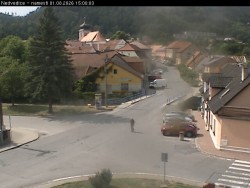
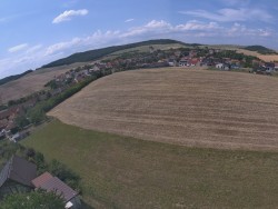
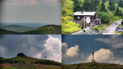
Webcams Europe > Czech Republic
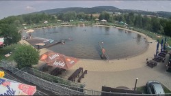
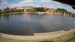
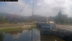
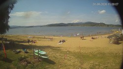
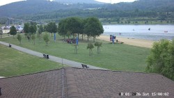
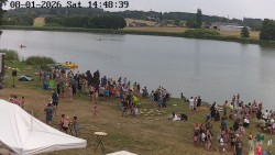
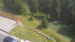
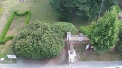
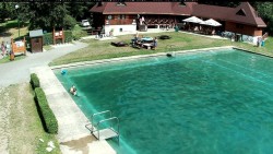
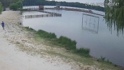
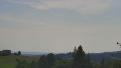
Biotope Swimming Area Radotín - Swimming lake
View of the Radotín biotope swimming lake and further towards Zbraslav.
Source: SouthPrague.Net, z.s.
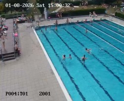
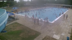
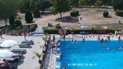
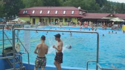
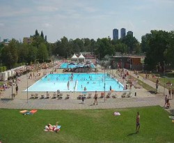
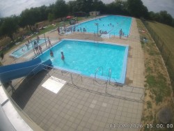
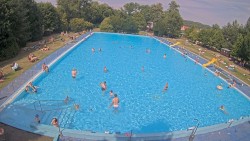
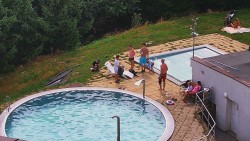
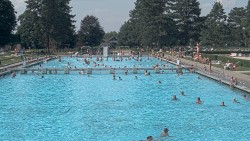
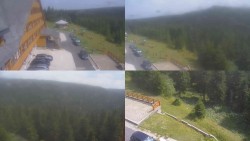
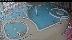
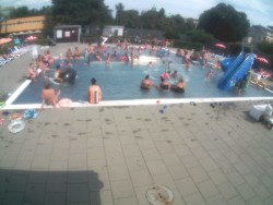
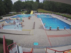
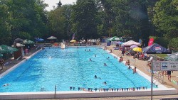
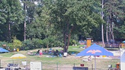
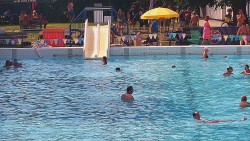
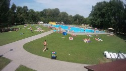
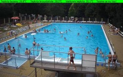
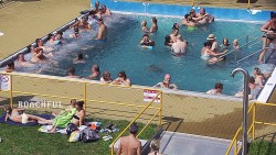
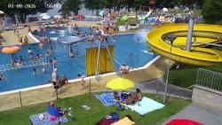
Petynka Swimming Pool - Main pool
View of the main pool at the Petynka swimming pool

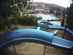
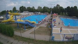
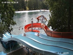
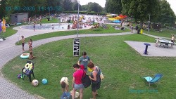
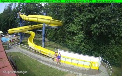
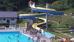
Petynka Swimming Pool - Slide
View of the waterslide and the swimming pool area
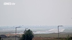
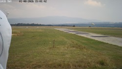
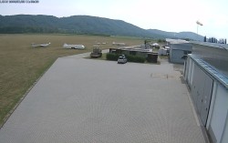
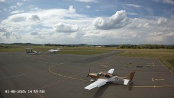
City of Prague - Václav Havel Airport Prague
View of runways 24 and 06 at Prague’s Václav Havel Airport.
Source: tv.idnes.cz

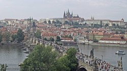
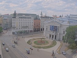
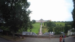
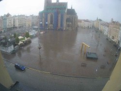
City of Prague - Prague Castle, Charles Bridge, Vltava
View from the right bank of the Vltava across Charles Bridge to the panorama of Prague Castle with St. Vitus Cathedral. The camera is operated by the Czech Union of Scientific and Technical Societies.
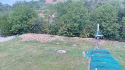
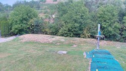
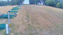
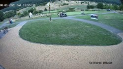
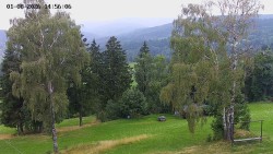
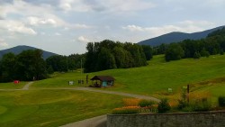
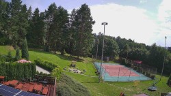
Devil’s Burden Golf Club - Holes 9 and 18
View of holes 9 and 18 at the Čertovo břemeno golf course
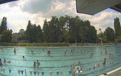
Velešín Swimming Pool - Swimming pool
View of the Velešín swimming area.
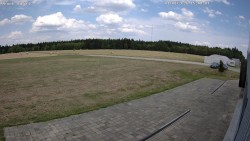
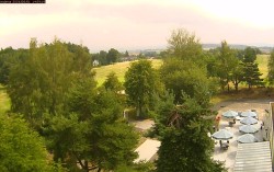
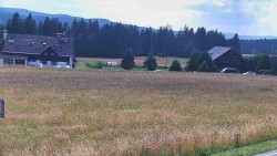
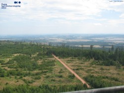
Jindřichův Hradec Airport - Jindřichův Hradec Airport
View of the airport operations area facing west.
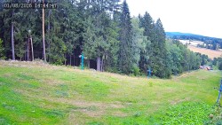
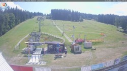
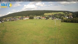
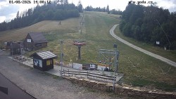
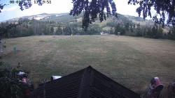
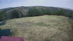
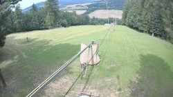
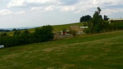
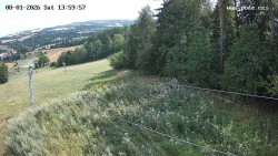
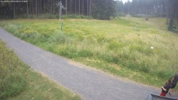
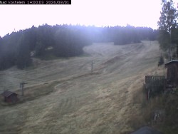
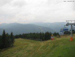
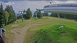
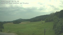
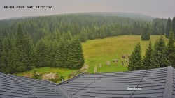
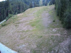
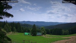
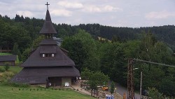
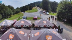
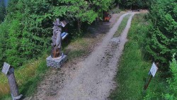
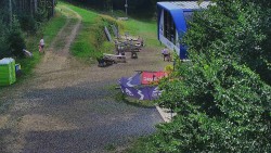
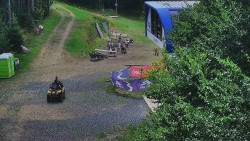
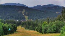
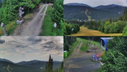
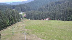
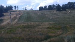
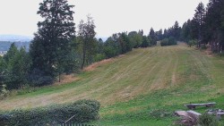
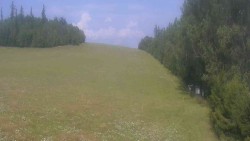
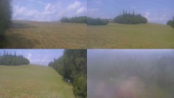
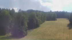
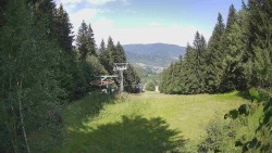
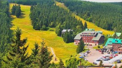
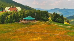
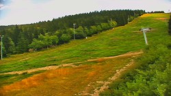
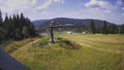
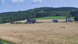
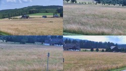
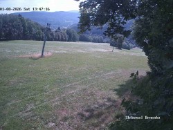
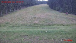
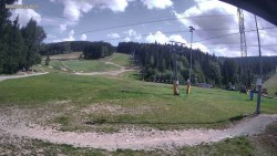
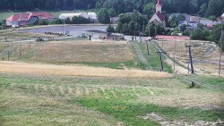
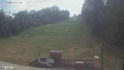
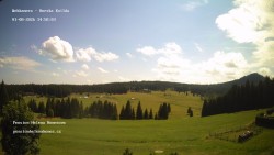
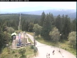
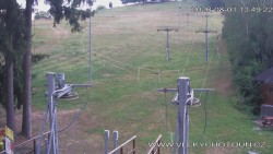
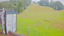
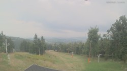
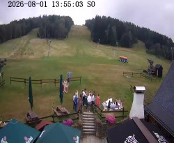
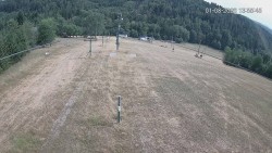
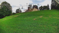
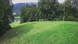
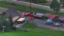
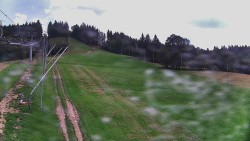
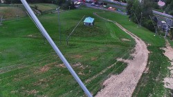
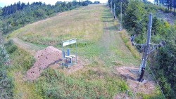
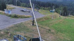
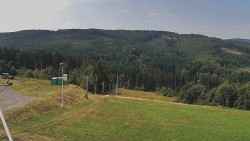
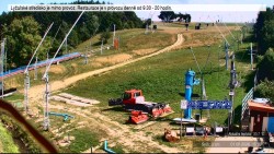
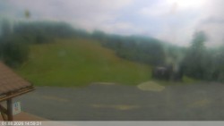
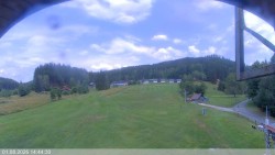
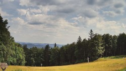
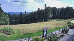
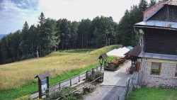
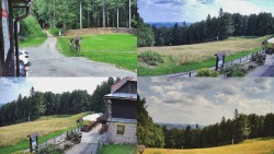
Hradiště Ski Resort - Ski slope
View of the ski slope at the Hradiště ski resort near Nová Bystřice.
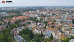
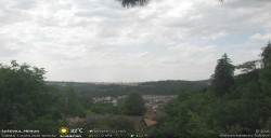
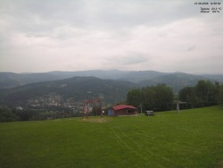
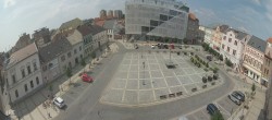
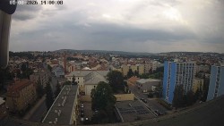
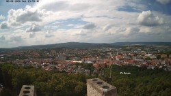
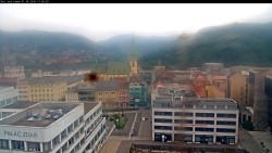
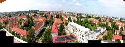
City of České Budějovice - City of České Budějovice
View of the city center of České Budějovice from the chimney of the local heating plant.
Source: www.teplarna-cb.cz
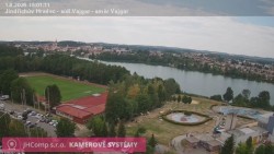
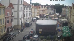
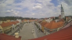
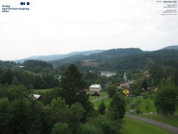
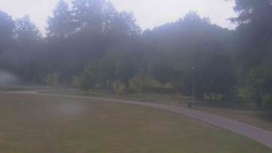
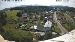
Town of Jindřichův Hradec - Town of Jindřichův Hradec
View across the Vajgar pond towards the center of Jindřichův Hradec
Source: JHComp s.r.o.
Town of Písek - Stone bridge
View from the restaurant Kozlovna u Plechandy of the Stone Bridge over the Otava River.
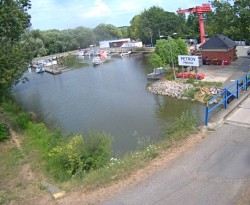
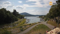
Town of Týn nad Vltavou - The town of Týn nad Vltavou
View across the Vltava River of the harbor in Týn nad Vltavou.
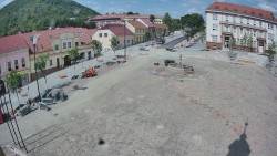
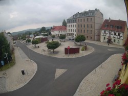
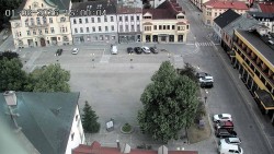
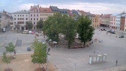
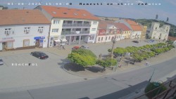
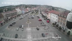
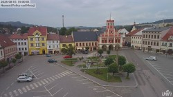
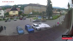
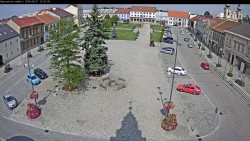
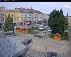
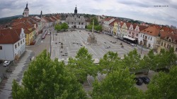
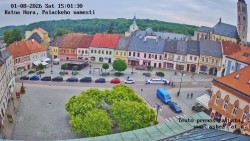
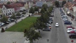
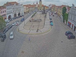
Town of Dačice - Palacký Square
View across Palacký Square towards the southeast.
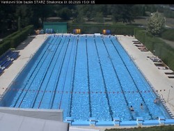
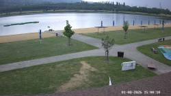
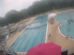
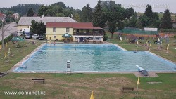
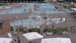
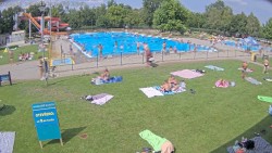
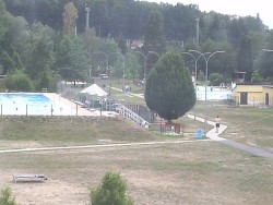
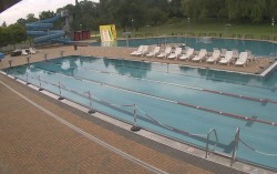
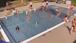
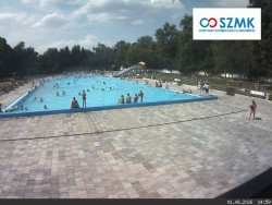
Strakonice Swimming Pool - Outdoor swimming pool
View of the main outdoor swimming pool at the swimming area in Strakonice.
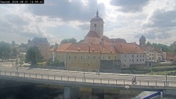
Strakonice City - Strakonice Castle
View of the Jan Palach Bridge and Strakonice Castle at the confluence of the Otava and Volyňka rivers.
Strakonice City - Strakonice Town
View of the confluence of the Otava and Volyňka rivers.
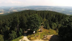
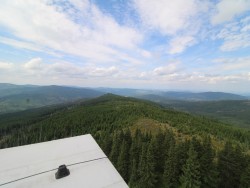
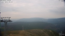
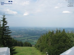
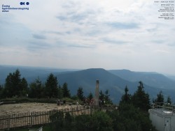
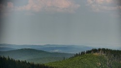
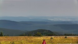
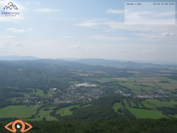
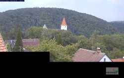
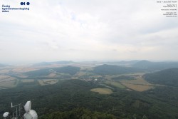
Kleť, Šumava Foothills - Kleť
View to the northeast from the observation tower on the summit of Kleť in the foothills of Šumava.
Source: www.teplarna-cb.cz


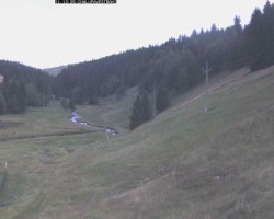
Zadov Ski Resort - Kobyla ski slope
View of the lower cable car station on the Kobyla ski slope.
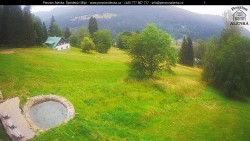
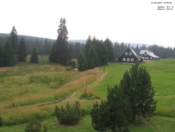
Municipality of Kvilda - Chalupa in the Hillside
View from Chalupy Ve Stráni into the Warm Vltava Valley.
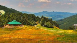
Municipality of Kvilda - Ski slope
Ski slope in the village of Kvilda in Šumava.
Poledník Observation Tower - Poledník Observation Tower
View from the Poledník lookout tower in Šumava towards the north to Prášily.
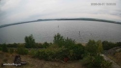
Černá v Pošumaví - Lipno
View of the Lipno Dam near Černá v Pošumaví from the windsurfing rental and school.

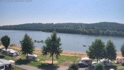
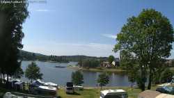
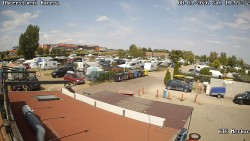
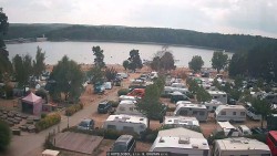
Town of Frymburk - Camping Frymburk
Camera in the campground area near the town of Frymburk on the shore of the Lipno Reservoir in Šumava
Town of Frymburk - Frymburk
View of the town of Frymburk on the shore of the Lipno Reservoir in Šumava
Town of Třeboň - Masaryk Square
View across Masaryk Square toward the Třeboň Castle.
Source: www.itrebon.cz
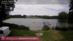
Town of Chlum u Třeboně - Town of Chlum u Třeboně
View across the Hejtman pond toward the village of Chlum u Třeboně
Source: JHComp s.r.o.
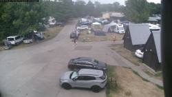
Autokempink Strážnice - Campsite area
View of the center of the Strážnice car camping area.
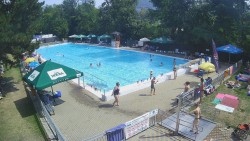
Autokempink Strážnice - Swimming pool
View of the large swimming pool at the summer swimming complex in the Strážnice campsite.
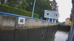
Baťa Canal - Petrov Lock
View of the mooring area in front of the Petrov lock on the Baťa Canal.
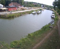
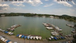
Baťa Canal - Port of Veselí nad Moravou on the Baťa Canal
The port on the Baťa Canal in Veselí nad Moravou offers a marina, a boat rental, a slipway, parking, and other services.
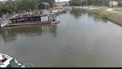
Baťa Canal - Hodonín Port
View of the "U Jezu" dock in the center of water tourism in Hodonín.
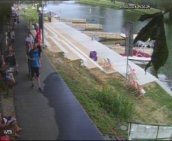
Baťa Canal - Petrov Pier
View of boat berths in the Petrov harbor on the Baťa Canal.
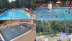
Slavkov u Brna Swimming Pool - Pool
Various views of the grounds of the Slavkov u Brna outdoor swimming pool.
Veselí nad Moravou Swimming Pool - Pool
View of the main pool of the swimming area in Veselí nad Moravou.
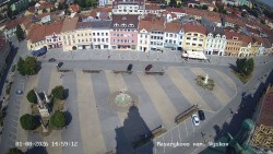
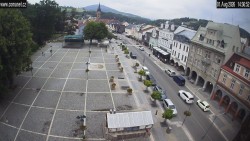
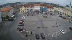
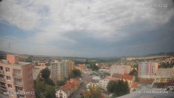
Town of Vyškov - Masaryk Square
View from the town hall tower of Masaryk Square in Vyškov.
Source: www.eleco.cz
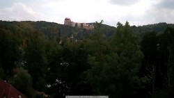
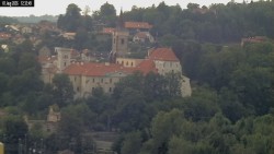
Town of Nedvědice - Pernštejn castle
View of Pernštejn Castle from the town of Nedvědice

Municipality of Letonice - Panorama
View of the village of Letonice from the southeast towards Rousínov.
Source: www.eleco.cz
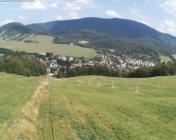
Hodonín u Kunštátu Ski Resort - Ski slope
View of the ski slope at the Hodonín Ski Resort from the lower lift station.
Hodonín u Kunštátu Ski Resort - Ski slope, eastern panorama
View of the upper part of the ski slope of the Hodonín u Kunštátu Ski Area, view towards the east.
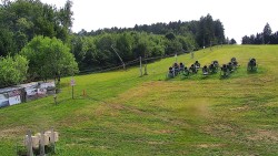
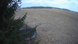
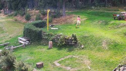
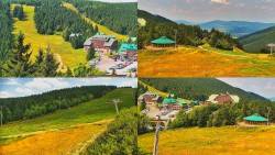
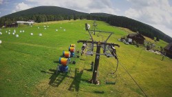
TJ Němčičky - Carpet
The camera shows the base layer of carpet on the ski slope.
TJ Němčičky - Swimming pool
Swimming pool of the Němčičky sports complex
TJ Němčičky - Rotating camera
Images from the rotating camera by the ski slope at the ski resort in Nemčičky
TJ Němčičky - Swah
Slope of the Němčičky ski resort
TJ Němčičky - Exit from the ski lift
Upper camera in the Němčičky ski resort
Filipov Ski Resort - Children's ski lift
Children's rope tow - static view
Filipov Ski Resort - Lower lift station
The building at the lower lift station in the Filipov ski resort.
Filipov Ski Resort - Ski slope
Ski slope of the Filipov ski resort
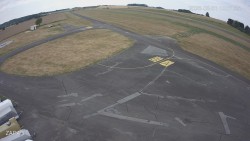
Břeclav Airport - Airport area
View across the Břeclav Airport area facing west.
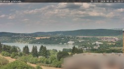
Brno Reservoir - Brno Reservoir
View of the Brno Reservoir from the Bystrc housing estate.
Brno Reservoir - Yacht Club BOATING SPORTS BRNO
View from the marina of TJ Lodní sporty Brno across the Brno Reservoir toward the east.
Source: www.lsbyc.cz
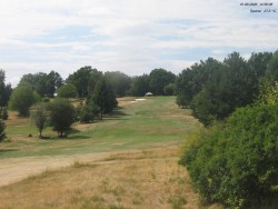
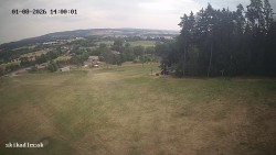
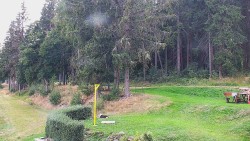
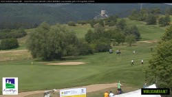
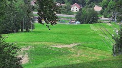
Kaskáda Golf Resort - Pit 1 and 18
View towards the 1st and 18th hole of the Káskáda golf course.
Dobrák Swimming Pool - Dobrák Swimming Pool
Grassy areas and pools of the Dobrák swimming area in Brno.
City of Brno - Malinovsky Square
Malinovsky Square and the Mahen Theatre
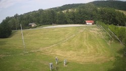
Kořenec Golf & Ski Resort - Golf course
View from the clubhouse toward the first hole.
Kotvrdovice Airport - Airport, Kojál
View from the Tři Sudy Kotvrdovice airport building looking east toward the Kojál transmitter.
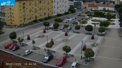
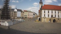
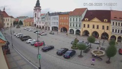
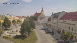
Town of Blansko - Republic Square
View of Republic Square in Blansko.
Source: www.alfservis.cz
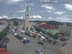
Market town of Jedovnice - Havlíček Square
View from the Jedovnice kindergarten towards Havlíček Square.
Source: ign.cz internet, s.r.o.
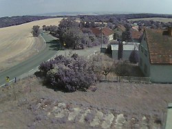
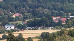
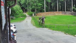
Municipality of Ježkovice - Entrance to the village from the north
View of the entrance to the village from the north of Ruprechtov.
Source: www.drvrkam.vys.cz
Municipality of Sloup - Sloup
View of the village of Sloup from Šošůvka
Town of Olešnice - Town of Olešnice
View of the town of Olešnice in Moravia from the Kopaniny viewpoint.
Ski Olešnice - Ski Olešnice
Overall view of the Ski Resort Olešnice in Moravia.
Ski Olešnice - Ski lift A exit
View of the exit of lift A.
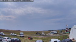
Pálava Protected Landscape Area - Autocamping Merkur - Pasohlávky
View from Kučera Refreshments into the Merkur campsite area in Pasohlávky.
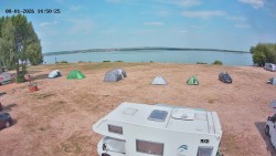
Pálava Protected Landscape Area - Kite Beach Pavlov
View of the site designated for kiteboarding at the Nové Mlýny reservoirs.
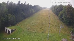
Town of Mikulov - Town of Mikulov
The square in Mikulov with the entrance gate to the garden of Mikulov Castle.
Tišnov Swimming Pool - Tišnov Swimming Pool
View of the main pool and the children's paddling pool at the Tišnov swimming pool.
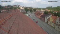
Town of Tišnov - Town of Tišnov
View of Peace Square in Tišnov and the Velká skála hill.
Town of Tišnov - Rieger Street
View down Riegerova Street in Tišnov toward Klucanina Hill.
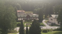
Town of Vranov nad Dyjí - Town of Vranov nad Dyjí
View of the Vranov nad Dyjí State Château.
Source: Vrancl Cameras
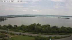
Vranov Reservoir - Vranov Reservoir
View of the water surface of the Vranov Reservoir with the dam and beach.
Source: Vrancl Cameras
Mramotice Swimming Pool - Pool
View of the pools at the Mramotice swimming pool.
City of Znojmo - City of Znojmo
View of the heliport of Znojmo Hospital looking south toward the town of Znojmo.
Source: Znojmo Hospital
Louka Municipal Swimming Pool - Swimming pool
View of the pools at the Louka swimming area and the Louka Monastery.
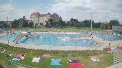
Karlovy Vary Spa - Panorama
Various views from the Thermal Hotel of the spa town of Karlovy Vary.
Source: Spa Hotel Thermal
Cheb Airport - Travel path, Runway
View of the taxiway and part of the runway.
Aš Ski Resort - Ski resort number one
View of the lower lift station by the Jednička ski slope.
Town of Abertamy - Náměstí Míru
View across Náměstí Míru facing south.
Municipality of Boží Dar - God’s Viewpoint
Various views from the Boží vyhlídka lookout tower towards Boží Dar.
Source: wolfnet.cz
Ski Hamry - Above the church
View of the ski slope Above the church.
Klínovec Ski Resort - Klínovec Peak
View from the summit of Klínovec towards the southwest.
Source: www.chmi.cz
Klínovec Ski Resort - Pařezovka ski slope, CineStar Express cable car
View of the lower part of the Pařezovka ski slope towards the summit of Klínovec.
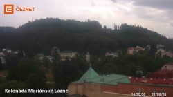
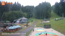
Town of Mariánské Lázně - Colonnade
Different views of the center of Mariánské Lázně.
Source: www.ceznet.cz
Mariánky Ski Resort - Lower cable car station
View of the end of the ski slopes at the Mariánky Ski Area.
Source: www.ceznet.cz
Michal Swimming Pool, Sokolov - Beach, water slide
View of the beach, a 190-meter-long toboggan and a slide at the Michal swimming area in Sokolov.
Michal Swimming Pool, Sokolov - Water surface
Water area of the Michal swimming pool in Sokolov.
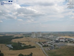
Dukovany Nuclear Power Plant - Dukovany Nuclear Power Plant
View of the Dukovany Nuclear Power Plant from the northwest.
Source: www.chmi.cz
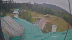
Kadlečák Ski Resort - Ski slope
View of the ski slope of the Kadlečák ski area near Světlá nad Sázavou.
Town of Humpolec - Upper Square
View of Upper Square in Humpolec.
Town of Humpolec - Humpolec from Orlík Castle
Various views of the town of Humpolec from Orlík Castle near Humpolec.
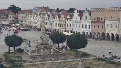
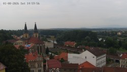
Town of Telč - Town of Telč
View of the historic center of the town of Telč, which is listed as a UNESCO World Cultural Heritage Site.
City of Jihlava - City of Jihlava
View of the plague column on Masaryk Square in Jihlava.
Třebíč Airport - Třebíč Airport
View of the Třebíč airfield area towards Klučovská hora.
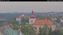
Town of Třebíč - City of Třebíč
View of the historic center of Třebíč from the south, from the Na Kostelíčku viewpoint.
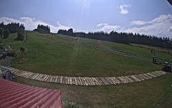
Ski Club Velké Meziříčí - Fajt's Hill - Ski slope
View of the Ski Club Velké Meziříčí ski slope - Fajtův kopec.
Town of Bystřice nad Pernštejnem - Town of Bystřice nad Pernštejnem
Masaryk Square in Bystřice nad Pernštejnem. City Museum, Column of the Virgin Mary, Church of Saint Lawrence.
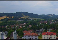
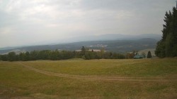
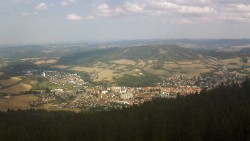
Nové Město na Moravě - Northwest panorama
View from Tyršova Street to the northwest towards Harusův Hill.
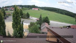
Municipality of Tři Studně - Municipality of Tři Studně
View of the parking lot in the village of Tři Studně in the Vysočina Region.
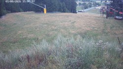
Ski Snowpark Harusův Hill - Harusák - Ski slope
View of the Ski Harusák ski slope in Nové Město na Moravě.
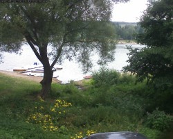
Červený Kostelec - Brodský Pond
View of the Brodský Pond from the Brodský campsite near Červený Kostelec.
Františkovy Lázně Golf Resort - Golf course
View from the main building of the golf club near Františkovy Lázně looking south toward the village of Hazlov.
Kuks Hospital - Hospital
View from the spa across the Elbe River to the Kuks Hospital building.
Source: www.avatech.cz
Nové Město nad Metují Airport - Airport area
View looking west across the Aeroclub Nové Město nad Metují airfield.
Source: www.aknm.cz
Town of City - Jiřího z Poděbrad Square
View of Jiřího z Poděbrad Square in Hořice.
Rozkoš Reservoir - Rozkoš Reservoir
View across the Rozkoš Reservoir towards the southeast to Nové Město nad Metují.
Source: www.rtyne.net
Zvičina - Hotel under Zvičina
View from Hotel pod Zvičinou towards Zvičina.
Source: www.hotelpodzvicinou.cz
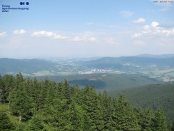
Zvičina - View to the north, Krkonoše
View from Zvičina looking north towards the panorama of the Krkonoše Mountains.
Source: www.avatech.cz
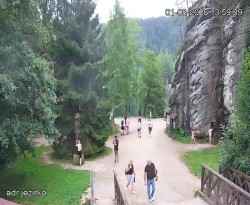
Adršpach - Entrance to the rocks, Sandpit
Entrance to the rock city, lake in the sandstone quarry.
Source: www.adrspasskeskaly.cz
Town of Police nad Metují - Masaryk Square
View of the town hall across Masaryk Square. On the left, Ostaš Hill.
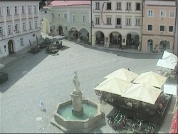
Town of Dobruška - F. L. Věk Square in Dobruška
F. L. Věk Square in Dobruška with the Marian column and fountain
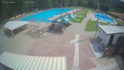
Flošna Swimming Pool - Flošna Swimming Pool Complex
View of the pools of the Flošna summer swimming pool in Hradec Králové.
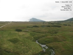
Meadow Chalet - Luční Bouda, source of the White Elbe
View from Luční bouda of the source area of the White Elbe, the Úpa peat bog in the vicinity of the source of the Úpa, and Sněžka.
Janské Lázně Town - Colonnade, Freedom Square
View of the colonnade in the center of the town of Janské Lázně
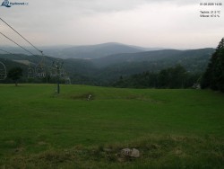
Town of Rokytnice nad Jizerou - Bald Mountain, view to the east
View from Lysá hora toward the start of the red ski slope of the Horní Domky ski resort. In the shot is Vlčí hřbet below Dvoračky.
Town of Rokytnice nad Jizerou - Lysá Mountain, view to the west
View from Lysá hora toward the start of the blue ski slope at the Horní Domky ski area.
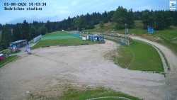
Town of Rokytnice nad Jizerou - Center of the municipality of Rokytnice nad Jizerou
The center of the municipality of Rokytnice nad Jizerou with an elementary school, library, and town hall.
Town of Vrchlabí - T. G. Masaryk Square
View of T. G. Masaryk Square in Vrchlabí in the Krkonoše Mountains. In the background, Žalý Hill.
Sněžka - Sněžka – cable car from Pec pod Sněžkou
Giant Mountains, Sněžka – 1,602 m above sea level, cable car from Pec pod Sněžkou
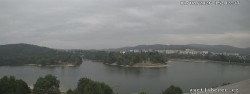
Town of Špindlerův Mlýn - Bedřichov
View from Bedřichov towards the eastern part of Špindlerův Mlýn, to Pláně and to the Svatý Petr valley.
Town of Špindlerův Mlýn - Svatý Petr, Planě
View from Přední planina to the Špindlerův Mlýn valley. From left: Kotel, Krkonoš, Horní Mísečky, Medvědín and Vysoké Kolo.
Guesthouse Alenka - Elbe, Reservoir
View from the Alenka guesthouse of Svatý Petr, Hromovka, and the Labská Reservoir.
Fort Dobrošov - Náchod
View from the lookout tower on Dobrošov Hill facing west toward the town of Náchod and Náchod Castle.
Mountain Resort Buková Hora - Čenkovice - Červenovodské Saddle
View of the parking lot at Červenovodské Sedlo.
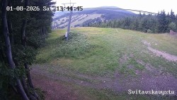
Mountain Resort Buková Hora - Čenkovice - Svitavská ski slope
View of the upper part of the Svitavská ski slope.
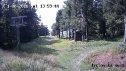
Mountain Resort Buková Hora - Čenkovice - Třebovská Ski Slope
View of the upper part of the Třebovská ski slope.
Dlouhoňovice Ski Resort - Ski slope
View of the ski slope of the Dlouhoňovice ski area, with the main ridge of the Orlické Mountains in the background
Říčky Ski Center - Slalom ski
View of the Slalomka ski slope in the Říčky ski center
Říčky Ski Center - Terminal station Zakletý
View of the beginning of the ski slopes at the Říčky ski resort
Sports complex České Petrovice - Ski slope B
View of the ski slope by lift B.
Dry Peak - Dry Peak
View of the parking lot on Suchý vrch in front of Kramářova Chalet.
Kruh Swimming Pool - Swimming pool
View of the swimming pool at the public swimming area in Kruh near Jilemnice.
Trosky Castle - Trosky Castle
View of Trosky Castle. On the left side the “Maiden” tower, on the right the “Crone” tower
Source: www.pension-jana.cz
Kozákov - View to the south, Trosky Castle
View from the top of Kozákov Hill to the south towards Trosky Castle.
Municipality of Svijany - Svijany, Ještěd
View from the south of the village of Svijany and Svijany Castle. Ještěd in the background.
Source: ITBUSINESS, s.r.o.
Kozákov Ski - Lower part of the ski slope
View of the lower part of the ski slope at the Kozákov ski resort.
Mšeno Reservoir - Mšeno I
View across the water surface of the Mšeno I reservoir in Jablonec nad Nisou facing east.
Source: anetliberec.cz
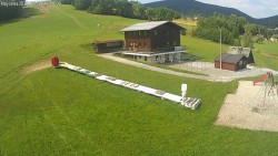
Bedřichov Cross-Country Skiing Area - Jizera 50 Start
View of the start area of the Jizerská 50 race.
Source: Jizerská o.p.s.
Ski Resort Kořenov - Rejdice - Morávka Ski Slope - Štěpánka
View from the ski slope of the Rejdice ski resort towards Velké Hamry, with Ještěd in the background.
Municipality of Josefův Důl - Hotel Pearl of the Jizera
View from the Perla Jizery hotel toward the northern end of the village of Josefův Důl, to the Lucifer ski area.
Source: www.perlajizery.cz
Jizerka settlement - Crane House
A place called Jeřábkovna in the Jizerka settlement.
Source: www.hydronet.cz
Smedava - Smědava, Black Hill
View from the Směďava mountain lodge toward the southeast to Černý vrch.
Kamenec Ski Resort - Jablonec nad Jizerou - View of the Krkonoše Mountains
View from Jablonec nad Jizerou to the northeast of the panorama of the Krkonoše Mountains.
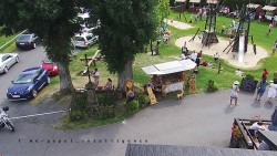
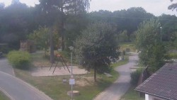
Municipality of Benecko - Children's park
View of the winter children's park near the center of the village of Benecko.
Municipality of Benecko - Family arena, snow tubing
View from the Skalka Hotel of the snowtubing area and the Zvon 1 ski slope.
Žalý Observation Tower - Žalý, Giant Mountains, Jizera Mountains
Views from the Žalý lookout tower of Vrchlabí, the Krkonoše Mountains, the Jizera Mountains, Medvědín, Černá hora, and other places in the surrounding area.
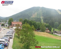
Harrachov City - City center
Harrachov town center in the Krkonoše Mountains.
Ještěd - Ještěd, Liberec
View from the Ještěd Hotel of the upper cable car station and the city of Liberec.
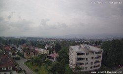
City of Liberec - Dolní Hanychov, Jizera Mountains
View from Dolní Hanychov across Liberec to the Jizera Mountains.
Source: www.anetliberec.cz
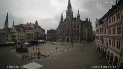
City of Liberec - Dr. Edvard Beneš Square
View of the Liberec City Hall on Dr. Edvard Beneš Square.
Source: www.anetliberec.cz
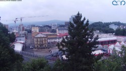
City of Liberec - Tram depot
View of the Liberec–Jablonec tram line depot.
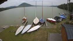
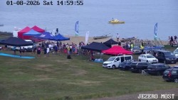
Máchův Lake Yacht Club - Mácha Lake, Borný, Bezděz
View from Staré Splavy across Lake Mácha toward the east to Borný Hill and Bezděz Castle.
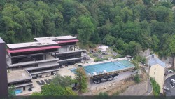
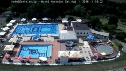
Hradec nad Moravicí Swimming Pool - Main pool
View of the main pool of the swimming area in Hradec nad Moravicí.
Town of Štramberk - Square, Castle and Trůba
View across the square toward Štramberk Castle and the Štramberk Trúba Tower
SEVERKA Ski Resort in Dolní Lomná - Severka Mountain Hut - Dolní Lomná
Arrival at the cottage - snack bar with seating
SEVERKA Ski Resort in Dolní Lomná - Severka Chalet - Dolní Lomná
Outdoor pool - Severka cottage
SEVERKA Ski Resort in Dolní Lomná - Severka Cottage - Dolní Lomná
Severka Cabin - composite image

SEVERKA Ski Resort in Dolní Lomná - Ski slope SEVERKA
View of ski slopes 1 and 3 at the Severka ski resort in Dolní Lomná
Golf & Ski Resort Ostravice - Golf course, Lysá Hora, Smrk
Various views from the Ostravice golf course of the Beskydy Mountains. In the photos, you can see Lysá hora or Smrk.
Upper Bečva - Hotel Duo
View from Hotel Duo across the Rožnovská Bečva valley
Mountain lodge House of St. Joseph - Beskids
View from Grůň to the southeast toward the border ridge with Slovakia.
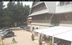
Čarták Mountain Hotel in Soláň - Hotel Čarták – parking lot
The camera captures the parking lot in front of the Čarták Hotel.
Čarták Mountain Hotel in Soláň - Information Center Bell Tower
In the camera image, there is a bell tower with an information center.
Čarták Mountain Hotel in Soláň - Panorama of the Javorníky Mountains
View from the north from Soláň to the ridges of the Javorníky Mountains.
Čarták Mountain Hotel in Soláň - View of the Amphitheatre
View of the Amphitheater of the Čarták Soláň Hotel
Maple Peak - Red ski slope, Třinec
View of the start of the red ski slope on Javorový vrch. In the valley, Třinec and Český Těšín can be seen.
Lysá hora - View to the southwest, Smrk
View from Lysá hora to the southwest, towards the Smrk and Kněhyně massif,
Source: www.chmi.cz
Pustevny - Saddle
View from the Pustevny saddle towards the ridge to Radhošť.
Source: www.hvfree.net
Ski resort at Sach's spring - Radhošť
View from Sachova Studánka to Radhošť
Bílá Ski Resort - White - running track
Camera by the ski resort Bílá running track
Bílá Ski Resort - White - panorama
Ski slope of the Bíla ski resort, the Ostravice River valley, and the panorama of the Beskydy Mountains with Lysá hora.
Bílá Ski Resort - Cable car – upper station
The cable car’s upper station with a cross-country ski trail in the Bílá ski resort
Bílá Ski Resort - Ski slopes, Smrk, Lysá hora
View from the upper part of the ski slope of the Bílá ski resort, Smrk on the left, Lysá hora on the right.
Bílá Ski Resort - Composite image
Combined image from cameras at the Bílá ski resort. Ski slope, panorama of the Beskydy Mountains with Lysá hora, the upper lift station, and a cross-country ski trail.
Mezivodí Ski Resort - Cross-country skiing Mezivodí
Camera on the main ski slope in the Mezivodí ski area
Olešná Aquapark - Summer aquapark
View of the Olešná summer water park complex near Frýdek-Místek.
Annaberg - Ski slope
View of the ski slope of the Annaberg ski resort
Myslivna Cottage SKP Olomouc - Cross-country skiing area Nová Ves
View of the start of the loop of the Nová Ves cross-country skiing area
Myslivna Cottage SKP Olomouc - Cross-country skiing area Nová Ves – upper part
View of the upper part of the cross-country skiing circuit of the Nová Ves ski area
Myslivna Cottage SKP Olomouc - View into the landscape
View of the landscape towards Dolní Moravice and Bruntál.
Myslivna Cottage SKP Olomouc - Seating
View of the seating area with a fire pit by the Myslivna cottage
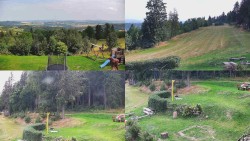
Myslivna Cottage SKP Olomouc - Composite photo of the surroundings of the Myslivna cabin
View of the landscape, part of the cross-country ski trail circuit of the Nová Ves ski area, and the surroundings of the Myslivna lodge
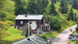
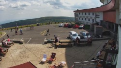
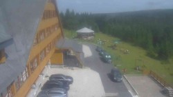
Mountain Hotel Volareza - Praděd - Mountain Rescue Service - Ovčárna - Praděd
Mountain Rescue Service - Ovčárna
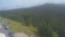
Mountain Hotel Volareza - Praděd - Panorama of the valley
Panorama of the valley
Mountain Hotel Volareza - Praděd - Composite image
Ovčárna, Praděd, and the access road to the hotel
Mountain Hotel Volareza - Praděd - Praděd transmitter
Praděd transmitter

Karlova Studánka Spa - Mountain spa
View from the Libuše spa house toward the Mountain Spa in Karlova Studánka.
Source: POLAR Television Ostrava
Town of Bruntál - Peace Square
View of Míru Square in Bruntál.
Source: mx-net.cz
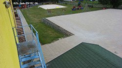
Schaumann Courtyard Guesthouse - Amphitheater - Playground
Amphitheater - Playground
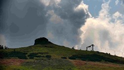
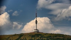
Praděd – Transmitter - Praděd - Transmitter
View of the parking lot in front of the transmitter on Praděd. In the background, Petrovy Kameny and Ovčárna.
Praděd – Transmitter - Praděd - Transmitter - Main entrance
View of the main entrance of the Praděd transmitter
Ski Club RD Rýmařov - Ski club area
Ski club area, view no. 1

Ski Club RD Rýmařov - Ski club premises
Ski club area, view no. 2
Ski Club RD Rýmařov - Ski club grounds
Ski club area, view no. 3
Ski Club RD Rýmařov - Children's playground
Children's playground, Edrovický Pond on the right
Ski Club RD Rýmařov - Composite image
Children's playground and ski club grounds
Ski Center Miroslav Lipová Lázně - Main slope run-out
Main ski slope access road
Old village - Football field
View of the football field and the Jeseníky mountain ridge
Old village - View to the south (4)
View to the south beyond the village of Stará Ves
Old village - Composite image
Views of the football field, the Jeseníky ridge, the center and surroundings of the village of Stará Ves
Opava Municipal Swimming Pool - Main pool
View of the main swimming pool of the municipal swimming pool in Opava.
Ostrava Poruba Outdoor Swimming Pool - Slide and slides
View of the waterslide and slides at the summer swimming pool in Ostrava-Poruba.
Kojetín swimming pool - Swimming pool
View of the main pool at the Kojetín swimming pool.
Hranice na Moravě Airport - Airport area, Helfštýn
View across the airfield of Hranice na Moravě Airport toward the southwest to Helfštýn Castle.
Town of Kojetín - Kojetín town
View of Masaryk Square from the Kojetín City Hall building.
Town of Přerov - Intersection of Komenského Street and Velké Novosady Street
View of the intersection of Komenského and Velké Novosady streets near the Tesco shopping center.
Town of Přerov - Intersection of Velká Dlážka Street and Polní Street
View of the intersection of Velká Dlážka, Polní, and Lipnická streets near the Lidl supermarket.
Town of Přerov - T. G. Masaryk Square
View across T. G. Masaryk Square looking north.
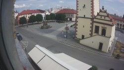
Town of Prostějov - T. G. Masaryk Square
View from the town hall of T. G. Masaryk Square in Prostějov
Červenohorské sedlo - Blue ski slope – run to the cable car station
View of the approach to the lower station of the cable car on the Blue slope in the Červenohorské sedlo ski resort.
Červenohorské sedlo - Panorama South Slopes, Hotel, Start "Yellow" ski slope
View of the accommodation at Červenohorské Sedlo and the ski slopes on the southern slopes.
Červenohorské sedlo - Restaurant "Deštník" – access via the yellow ski slope
View from Červenohorské Saddle towards the town of Jeseník and Bělá pod Pradědem.
Červenohorské sedlo - Composite image
Views of the hotel and ski slopes in the Červenohorské sedlo ski resort.
Červenohorské sedlo - Ski slope "connector"
View of the "Spojka" ski slope at the Červenohorské sedlo ski resort.
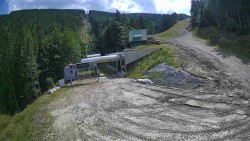
Mountain attractions Ramzová - Lower part of the ski slope at the Ramzová Ski Resort
View of the ski slope from the bottom station of the cable car
Mountain attractions Ramzová - Upper part of the ski slope at the Ramzová Ski Resort
The cable car’s upper station in the Ramzová Ski Area
Karlova Studánka ski lift - Ski slope
View of the ski slope at the Pradědova aréna ski resort.
Golden Mountains City - Overall view
A panoramic view of the town of Zlaté Hory from the lookout tower on Biskupská kupa.
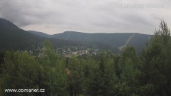
Municipality of Loučná nad Desnou - Loučná nad Desnou
View over the village of Loučná nad Desnou towards the ridges of the Jeseníky Mountains.
Municipality of Mikulovice - View of the Jeseníky Mountains
View from the church in the village of Mikulovice towards the southwest to the Jeseníky Mountains.
Rejvíz - Cross-country ski trails - Running tracks, NPR Rejvíz
View of the cross-country ski trails at Rejvíz in the Jeseníky Mountains and of the Rejvíz National Nature Reserve.
Rejvíz - Cross-country ski trails - Running routes, Férovka Chalet, Castle Hill
View of the cross-country ski trails at Rejvíz in the Jeseníky Mountains, the Férovka mountain hut, and Zámecký Pahorek.
Rejvíz - Cross-country ski trails - Rejvíz - Cross-country ski trails
Rejvíz - Cross-country ski trails
Rejvíz - Cross-country ski trails - Composite image
Various views of the village of Rejvíz in the Jeseníky Mountains and the condition of the cross-country ski tracks.
Brněnka Ski Resort and Ski Area - Ski slope, Vernířovice
View of the upper part of the ski slope and the village of Vernířovice.
Šerák - Šerák, Jeseník
View from Jiří’s Mountain Hut below the summit of Šerák toward the northeast to the town of Jeseník.
Source: www.chmi.cz
Ski Resort Klepáčov - Red ski slope
View of the red ski slope at the Klepáčov ski resort.
Kouty nad Desnou Ski Resort - Ski slope to the Snowpark
View of the K Snowpark ski slope in the lower part of the Kouty nad Desnou ski resort.
SKITECH Kunčice - Ski school and children's playground
View of the Hájovna area, the ski school, and the children's playground.
Sport Hotel Kurzovní - Parking lot and main entrance
View of the parking lot and the main entrance to the hotel
Sport Hotel Kurzovní - Petrovy kameny / Peter’s Stones
View towards Ovčárna, Petrovy kameny on the right
Sport Hotel Kurzovní - Access to the running track
Access to the running track of the Praděd ski resort
Sport Hotel Kurzovní - Composite image
Parking lot, Petrovy Kameny, Vysoké Hole, cross-country ski trail
Sport Hotel Kurzovní - Vysoké hole
View of the ridge behind Petrovy kameny toward Vysoké hole
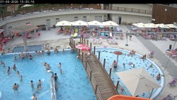
Thermal Baths Losiny - Outdoor pools
Outdoor pools of the Velké Losiny thermal baths.
Thermal Baths Losiny - Indoor pools
Indoor pools of the Velké Losiny thermal baths.
Litovel swimming pool - Swimming pool
View of the natural swimming biotope complex in Litovel.
Town of Litovel - Přemysl Otakar Square
A view of Přemysl Otakar Square in Litovel with access to the water level of the Nečíza branch of the Morava River.
Golf resort Olomouc - 18. pitfall
View of the 18th hole of the championship course at Golf Resort Olomouc
Slezská Harta - Leskovec nad Moravicí
The dock and boat rental at Slezská Harta.
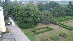
Municipality of Veselíčko - Driveway to the chateau
The camera monitors the access road to the castle in the village of Veslíčko.
Municipality of Veselíčko - Veselíčko – park by the chateau
The camera captures the adjacent park near the chateau in the village of Veselíčko
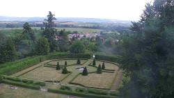
Municipality of Veselíčko - Veselíčko – garden by the chateau
A camera on one of the castle towers in the village of Veslíčko captures the garden in front of the castle.
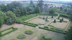
Municipality of Veselíčko - Veselíčko - the garden by the castle
A camera on one of the castle towers in the village of Veslíčko captures the garden in the immediate vicinity of the castle.
Hlubočky Ski Resort - Upper part of the ski slope at the Hlubočky ski resort
Camera view of the upper part of the ski slope and the surroundings of the Hlubočky ski resort near Olomouc
Hlubočky Ski Resort - Ski slope of the Hlubočky ski resort
The ski slope and surroundings of the Hlubočky ski resort near Olomouc
City of Olomouc - Upper Square
Upper Square in Olomouc. View of the town hall with the astronomical clock and the Holy Trinity Column
Olomouc Swimming Stadium - Children's outdoor swimming pool
View of an outdoor children's pool with attractions
Olomouc Swimming Stadium - Outdoor swimming pool
View of the main outdoor pool
Jablonné nad Orlicí Swimming Pool - Pool
View of the pool and the refreshment building in the swimming area in Jablonné nad Orlicí.
Ski Resort Polička - Liboháj - Ski slope
View of the ski slope at the Polička ski area.
Source: www.poda.cz
Summer swimming pool Chrudim - Summer swimming pool
View of the pools at the Chrudim outdoor swimming pool.
Town of Chrudim - Ressel Square
View of the Column of the Transfiguration of the Lord on Ressel Square in Chrudim.
Source: OMEGA plus Chrudim s.r.o.
Dolní Morava - Slaměnka chalet
Camera at the Slaměnka chalet at an altitude of 1,116 m above sea level, directly at the upper station of the Sněžník cable car.
Dolní Morava - Path in the Clouds
View from the upper station of the Sněžník cable car to the Sky Walk.
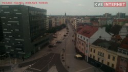
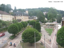
City of Pardubice - Třída Míru
View of the intersection of Třída Míru and 17. listopadu Street.
Source: KVE s.r.o.
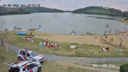
Seč Dam - Seč Beach Caravan Site
The dam near Seč Pláž campsite.
Seč Dam - Dam
View of the upper part of the Seč Dam from the Pod Drnem restaurant
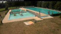
Kolinec Swimming Pool - Pools
View of the pools at the Kolinec swimming area
Nýřany swimming pool - Large swimming pool
View of a large swimming pool and a water slide at the swimming area in Nýřany near Plzeň.
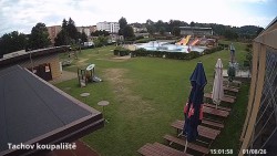
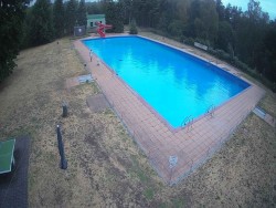
Tachov swimming pool - Swimming pool
View of the Tachov outdoor swimming pool complex.
Source: www.ceznet.cz
Horšovský Týn Town - City, Castle
View to the north across the town toward Horšovský Týn Castle and Chateau.
Source: www.unitednetworks.cz
Town of Nepomuk - Augustin Němejec Square
View across Augustin Němejec Square in Nepomuk toward the Church of St. John of Nepomuk.
City of Plzeň - Republic Square
View of Pilsen’s Republic Square with the Cathedral of St. Bartholomew.
Source: www.plzen.cz
City of Plzeň - Košutka Housing Estate
View of the Koštuka housing estate in Plzeň looking east toward Blovec..
Source: meteoplzen.cz
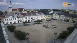
The town of Stříbro - Masaryk Square
View across Masaryk Square to the town hall and further westward.
Švihov Town - Panorama, Castle
View of the town of Švihov from the west. On the right side, Švihov Castle.
Source: www.unitednetworks.cz
School Apartments Míšov - Brdy
View from the village of Míšov towards the south.
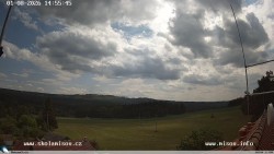
Čerchov - Observation tower, Panorama
Various views from the top of Čerchov in the Czech Forest.
Source: www.domazlice.eu
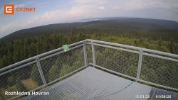
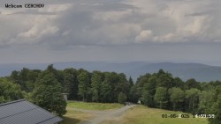
Havran Hora - Lookout tower
View from the Havran lookout tower.
Source: www.ceznet.cz
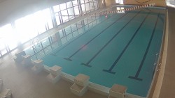
Klatovy Swimming Pool - Indoor swimming pool
Indoor swimming pool in Klatovy
Klatovy Swimming Pool - Summer swimming pool
The outdoor swimming pool area in Klatovy, a beach volleyball court.
Town of Klatovy - Peace Square
View of Míru Square in Klatovy with the Baroque pharmacy “At the White Unicorn,” and in the background the Archdeanery Church of the Nativity of the Virgin Mary.
Kašperské Hory Town - Square, Church of St. Margaret
View of the square with the Church of St. Margaret in Kašperské Hory.
Source: www.kasperske-hory.info
Town of Sušice - Panorama
View of the town of Sušice from Svatobor Hill.
Municipality of Horská Kvilda - Helena Honesová Guesthouse
View from Pension Helena Honesová looking south towards Antýgl Hill (Sokol).
Municipality of Modrava - Modrava
View of the center of the village of Modrava
Municipality of Zelená Lhota - Úhlava Valley, Královský Hvozd
View across the Úhlava River valley to the ridge of the Šumava Mountains with the Královský Hvozd nature monument.
Source: www.unitednetworks.cz
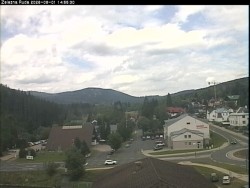
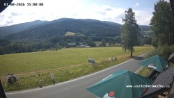
Town of Železná Ruda - Iron Ore
The town of Železná Ruda near the intersection of Špičácká and Javorská streets.
Špičák - Pancíř
The summit of Pancíř Hill above Železná Ruda. On the right side, Špičák.
Town of Kutná Hora - Palacký Square
View across Palacký Square facing south.
Source: nasbezdrat.net
Town of Mělník - Chloumek, Říp
View from the Mělník district of Chloumek toward the southwest; on the right is Mount Říp.
Source: rohatce.net
Town of Mnichovo Hradiště - Panorama of Mnichovo Hradiště
View from the town hall of the Church of St. James towards the Mnichovo Hradiště Castle.
Sázava City - Sázava Monastery
View across the Sázava River of the Sázava Monastery.
Source: www.daskonet.cz
Town of Vlašim - Jana Masaryka Street
View from the house onto Jana Masaryka Street in Vlašim facing north.
Source: Vlašimnet s.r.o.
Poděbrady - King George Ship - King George Ship - Poděbrady
King George Ship - Poděbrady
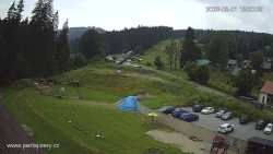
Chotouň Ski Resort - Ski slope
View of the lower part of the ski slope at the Chotouň ski resort.
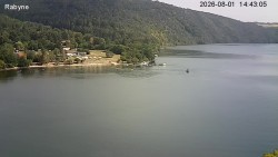
Slapy Reservoir - Slapy, Nová Rabyně, Lahoz
View from the village of Lahoz across the Slapy Reservoir to the campsite in Nová Rabyně
Source: www.slapyteplota.eu
Hill Prague - Brdy Weather Radar
View from the weather radar on Prague Hill in the Brdy Mountains towards the southeast to Rožmitál pod Třemšínem.
Source: www.chmi.cz
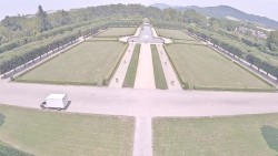
Golf Resort Karlštejn - Karlštejn
View from the club building to the north toward Karlštejn Castle.
Town of Beroun - Hus Square
View across Hus Square towards the west.
Town of Rakovník - Center
View east toward the center of Rakovník, onto Havlíčkova and Palackého streets.
Source: www.unitednetworks.cz
Municipality of Křivoklát - Křivoklát
View of the towers of Křivoklát Castle.
Source: www.krivonet.cz
Příbram Airport - Taxiway C, gas station, runway
View towards the west of taxiway C, the gas station and the runway of Příbram Airport.
Source: www.ok-aviation.com
Town of Příbram - Holy Mountain, Panorama
View from Svatá Hora near Příbram looking west across the town of Příbram toward the Brdy Mountains and Třemošná Hill
Podbořany Swimming Pool - Swimming pool
Various views of the Podbořany municipal swimming pool complex.
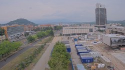
Town of Most - Center
Most city center, Hněvín Castle on the left, the Ore Mountains in the background.
Town of Most - Lake Most
Various views of Lake Most from the southern shore near Starý Most.
Town of Roudnice nad Labem - Czech Central Highlands, Elbe, Castle
Panorama of the České středohoří from the Hláska tower in Roudnice nad Labem. View of the town, the Elbe River, and the château.
Nechranice Reservoir - Nechranice Reservoir
View of the water surface of the Nechranice reservoir
Milešovka - Milešov
View from the summit of Mount Milešovka looking south toward the village of Milešov.
Source: www.chmi.cz
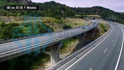
Prackovice nad Labem - Motorway D8, Lovoš
View of the D8 motorway near Prackovice nad Labem in the České Středohoří. In the background, Mount Lovoš.
Source: dopravniinfo.cz
Town of Chomutov - Stone Lake
View of the beach at the alum lake in Chomutov.
Town of Chomutov - May 1st Square
View of May 1st Square and the town tower.
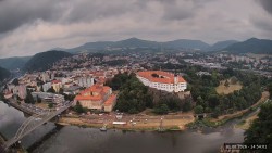
City of Děčín - Děčín Castle
View from the Shepherd's Wall across the Labe to Děčín. On the left is Tyrš Bridge and the city library; on the right is Děčín Castle.
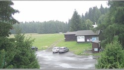
Mountain Association Adolfov - Running area parking lot
View of the parking lot near the starting point of the cross-country ski trails.
Alšovka Ski Resort - Měděnec - Upper part of the ski slopes
View from the upper part of the ski slopes towards the east.
Ski Resort of the town of Meziboří - Boarding the ski lift
View of the lower part of the ski slope and the lift boarding area.
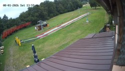
Bouřňák Sports Center - Vlek Mikulov, Slalom slope
View of the lower part of the Slalom ski slope and the lifts from the village of Mikulov.
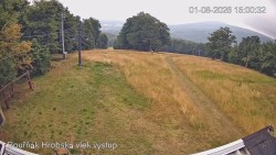
Bouřňák Sports Center - Bouřňák Peak, view to the south
View to the south from the summit of Bouřňák hill in the Ore Mountains
Ski Resort Horní Podluží - Boarding station of the Horní Podluží ski lifts
View of the Ski Resort slopes
City of Ústí nad Labem - City center
Ústí nad Labem city center. View from the regional office of the Zdar Palace, Mírové Square, and the Church of the Assumption of the Virgin Mary.
Town of Žatec - Freedom Square
Different views of Svobody Square in Žatec.
Žatec Municipal Swimming Pool - Swimming pool area
View of the pools and attractions at the municipal swimming pool in Žatec
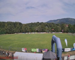
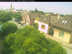
Football Club Bystřice pod Hostýnem - Football stadium, Kelčský Javorník
View across the football stadium in Bystřice pod Hostýnem looking east toward Kelčský Javorník.
Chropyně Swimming Pool - Main pool, wild river
View of the main pool, wild river, and waterslide at the swimming pool in Chropyně.
Hluk Swimming Pool - Hluk Swimming Pool
The swimming pool complex in the village of Hluk, view of the village center.
Municipality of Rusava - Camera at the Jubilee Primary School of T. G. Masaryk and Kindergarten
Camera shot of the Jubilee Elementary School of T. G. Masaryk and the Kindergarten in the municipality of Rusava
Recreation Center Trnava near Zlín - Main ski slope
Camera at the main ski slope of the Trnava–Luhy ski resort
Recreation Center Trnava near Zlín - Small ski lifts
Camera at the small ski lifts of the Trnava-Luhy ski resort
Recreation Center Trnava near Zlín - Boarding the ski lift
View of the boarding area for the ski lift at the Trnava-Luhy ski resort
Karolinka Ski Resort - Karolinka Town
The camera footage shows a view of the town of Karolinka.

Karolinka Ski Resort - Rotating camera on the ski slope
The camera captures the ski slope, the upper part
Karolinka Ski Resort - The middle section of the ski slope and the snowpark
The camera captures the middle part of the ski slope and the snowpark of the Karolinka ski resort.
Karolinka Ski Resort - Restaurant U Vleku and parking lot
The camera shows the U Vleku Restaurant and the parking lot of the Karolinka ski resort.
Karolinka Ski Resort - Karolinka ski slope
View of the middle section of the ski slope at the Karolinka Ski Area
Karolinka Ski Resort - Lower part of the Karolinka ski resort slope
In the camera shot, the lower part of the ski slope at the Karolinka ski resort is visible.
Troják Ski Area - Camera at the lift boarding area, slope A
The camera captures the boarding area of the ski lift on the main slope of the Troják ski resort.
Troják Ski Area - Rotating camera, slope A
Footage from a rotating camera located in the center of the Troják ski resort. View of the parking lot, slope A, the restaurant, and the hotel.
Troják Ski Area - Panorama Vičanov - Tesák
View of Vičanov, Tesák in the Hostýn Mountains
Troják Ski Area - Three-man - Mary - Lookout Tower
Troják - Maruška - Lookout Tower
Troják Ski Area - Troják, Maruška - weather station
Footage from the grounds of the CHMI meteorological station on Maruška Hill in the Hostýn Hills.
Troják Ski Area - Troják, Maruška - Weather Station
The camera shows the Czech Hydrometeorological Institute’s weather station from Maruška hill above the Troják ski resort.
Troják Ski Area - Troják, Maruška - HM52 rest area
The camera covers the rest area of the Hostýn cross-country ski trail HM52
Troják Ski Area - Troják, Maruška - panorama
The camera shows the Hostýn Hills from Maruška Hill above the Troják ski resort.
Troják Ski Area - Troják, Maruška - parking lot
The camera shows the parking lot from Maruška Hill above the Troják ski resort.
Saint Hostýn - Basilica of the Assumption of the Virgin Mary
View of the main entrance to the Basilica of the Assumption of the Virgin Mary at Hostýn.
Bystřice pod Hostýnem Swimming Pool - Pool
View of the main pool at the swimming pool in Bystřice pod Hostýnem
Bystřice pod Hostýnem Swimming Pool - Beach volleyball
Beach volleyball court at the swimming pool in Bystřice pod Hostýnem.
Bystřice pod Hostýnem Swimming Pool - Wading pool
Children's paddling pool at the swimming pool in Bystřice pod Hostýnem.
Bystřice pod Hostýnem Swimming Pool - Main pool
Overall view of the main pool at the swimming area in Bystřice pod Hostýnem.
Bystřice pod Hostýnem Swimming Pool - Composite image
View of the children's paddling pool, the main pool, and the surroundings of the pool in Bystřice pod Hostýnem
Bystřice pod Hostýnem Swimming Pool - Slide
Waterslide into the main pool at the swimming pool in Bystřice pod Hostýnem.
Town of Bystřice pod Hostýnem - Bystřice pod Hostýnem, Czechoslovak Brigade Street
Čs. Brigády Street heading toward the center of Bystřice pod Hostýnem.
Stupava ski resort - Ski slope
View of the main ski slope of the Stupava ski resort.
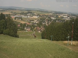
Town of Holešov - Town of Holešov
View of Dr. E. Beneš Square in Holešov
Source: www.avonet.cz
Town of Holešov - Town of Holešov
View from Holešov Castle into the castle garden and to the Hostýn Hills
Source: RAAB Computer s.r.o.
Castle Swimming Pool Holešov - Holešov Castle Swimming Pool
Footage from the grounds of the Château Swimming Pool in Holešov
Osíčko Swimming Pool - Main pool
Camera view of the main pool at the Osíčko swimming area
Osíčko Swimming Pool - Slide
Camera at the water slide at the swimming pool in Osíčko
Municipality of Držková - Vančica Hill
View from Vančica hill towards Kašava, with the Javorníky and the Vizovice Hills in the background.
Rusava Swimming Pool - Children's paddling pool
Camera by the children's paddling pool at the Rusava swimming pool in the Hostýn Hills
Rusava Swimming Pool - Cash register
View of the cash desk at the Rusava swimming pool in the Hostýn Hills.
Rusava Swimming Pool - Composite images
Combined photos from the Rusava swimming pool: pool, children's paddling pool, water slide
Rusava Swimming Pool - Slide
In the camera image, there is a water slide at the Rusava swimming pool.
Rusava Swimming Pool - Whirlpool bath Rusava
Camera in the whirlpool at Rusava swimming pool
Hulín Swimming Pool - Hulín Swimming Pool
Random shots from the outdoor swimming pool area in Hulín
Hulín Swimming Pool - Hulín Swimming Pool
Composite images from the outdoor swimming pool complex in Hulín. The main pool, the children's pool and the swimming pool building.
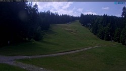
Razula Ski Resort - Lower part of the ski slope
View of the lower part of the Razula ski slope.
Razula Ski Resort - Horal Ski Slope, Horal Golf Club
View of the Horal ski slope and the golf course area.
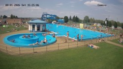
Bajda Swimming Pool, Kroměříž - Main pool
The main pool and the Bajda swimming pool complex in Kroměříž
Town of Kroměříž - Slovan
View from the Slovan housing estate looking north toward the city center.
Source: www.mesto-kromeriz.cz
Town of Kroměříž - Velké náměstí
View from the town hall across the Velké náměstí to the Archbishop’s Château, Kroměříž.
Source: www.mesto-kromeriz.cz
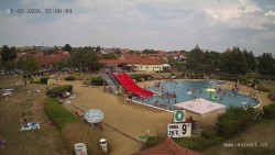
Pozlovice swimming pool - Swimming pool
Various views of the swimming pool complex
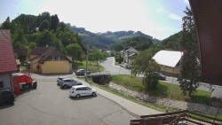
Town of Rožnov pod Radhoštěm - Meziricska Street
View across Meziříčská Street toward Radhošť and the Rožnovská Bečva Valley.
Source: www.hvfree.net
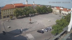
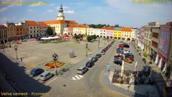
Town of Uherské Hradiště - Masaryk Square
View of Masaryk Square
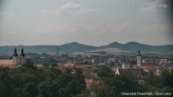
Town of Uherské Hradiště - Panorama
Different views of Uherské Hradiště
Ski Resort - Mountain Hotel Vsacký Cáb - Entering the running tracks
Access to the running trails at Vsacký Cáb in the Vsetín Beskids
Ski Resort - Mountain Hotel Vsacký Cáb - Lift boarding station
The lift’s boarding station at Vsacký Cáb in the Vsetín Beskids
Ski Resort - Mountain Hotel Vsacký Cáb - Panorama from Vsacký Cáb
Panorama from Vsacký Cáb in the Vsetín Beskids
Ski Resort - Mountain Hotel Vsacký Cáb - Composite image
Composite image from cameras on Vsacký Cáb in the Vsetín Beskydy Mountains
Ski Resort - Mountain Hotel Vsacký Cáb - Terrace of a mountain hotel
View of the terrace of the mountain hotel Vsacký Cáb in the Vsetín Beskids
Kostelec u Zlína Spa - Swimming pool complex
View of the heated pools of the Kostelec u Zlína spa.