


Webcams Europe > Czech Republic > Liberec Region > Giant Mountains > Benecko
Camera type: All types of cameras
Basic airfield data for Kotvrdovice airfield:
Frequency - 123.480 MHz, call sign KOTVRDOVICE RADIO
Location - 49°21´52´´N 016°47´14´´E Elevation 556 m / 1857 ft
Runway - 10/28, 600 x 45 m, grass
AD: Circuit always to the north (over the forest, outside built-up areas). Caution: transmitter 1.5 NM NE of the airfield. Taxi along the southern edge of the runway. Beware of the electric fence around the RWY (height 70 cm). When landing on 28, beware of turbulence from the forest.
NOISE: Do not fly over the village of Kotvrdovice! Minimum flight altitude over the Moravian Karst Protected Landscape Area 500 m / 1670 ft AGL.
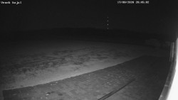
Kotvrdovice Airport - Airport, Kojál
View from the Tři Sudy Kotvrdovice airport building looking east toward the Kojál transmitter.
